Views worth 1000 likes - 10 viewpoints in the Świętokrzyskie region
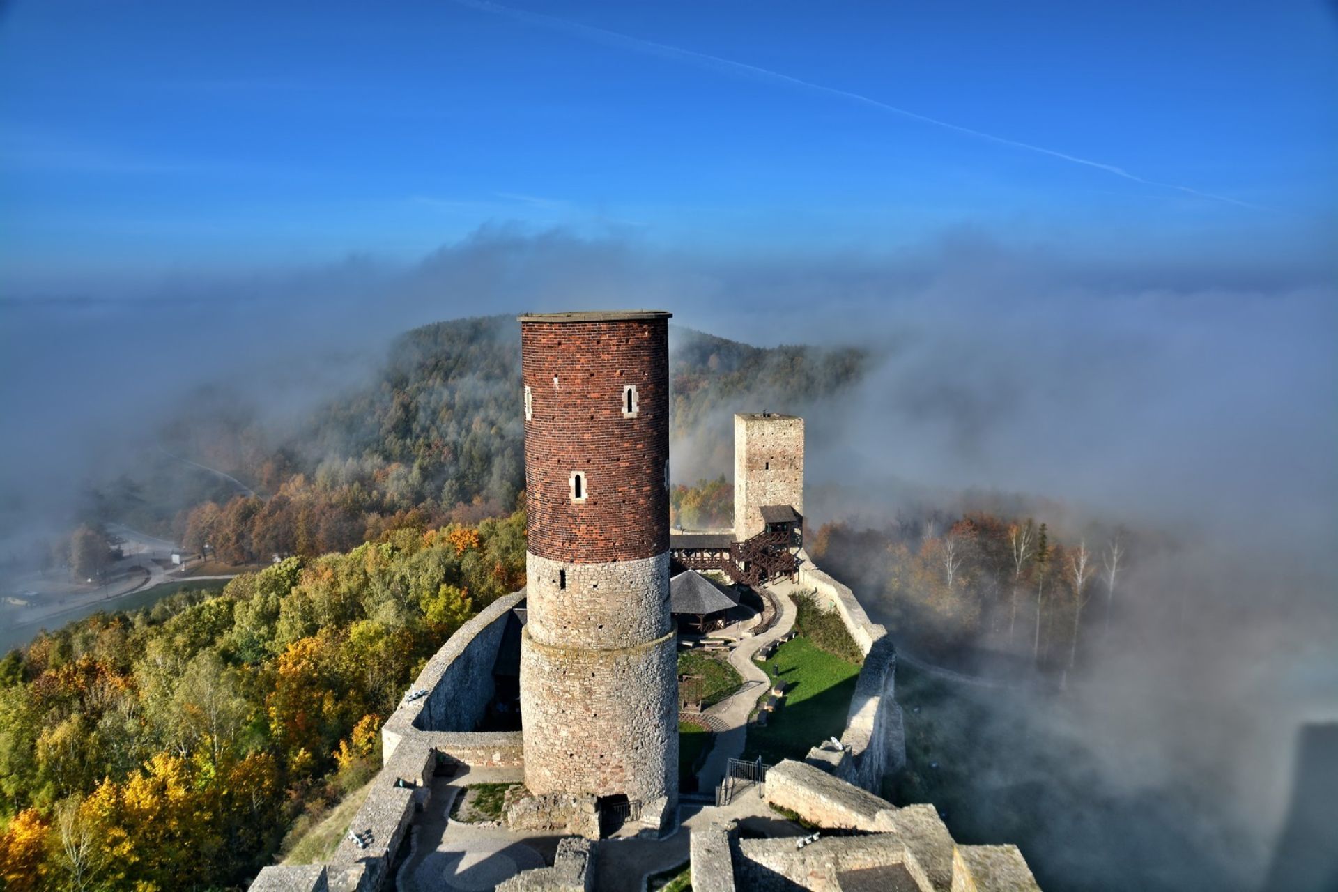
Chęciny - on the border of two lands
We start with something obvious - the viewing tower of the royal castle in Chęciny. It rises 25 metres above the level of the fortress courtyard, which for centuries has stood proudly on Castle Hill rising 360 metres above sea level.
From here you can look down on the castle courtyard, the town of Chęciny, the Świętokrzyskie Mountains and the gentle, lazy Ponidzie. And with a bit of luck, you can even see... the Tatra Mountains. The point is easily accessible. Remember, however, that there is a winding and rather steep staircase leading up to the castle tower. How many steps are there? Try counting them yourself! As it turns out it's not an easy task at all.
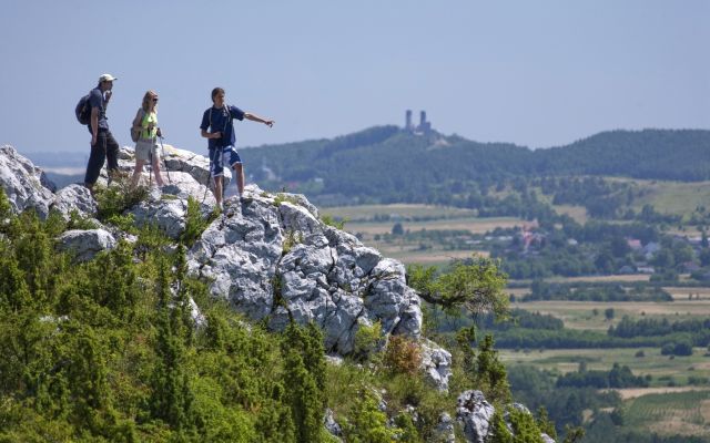
Miedzianka
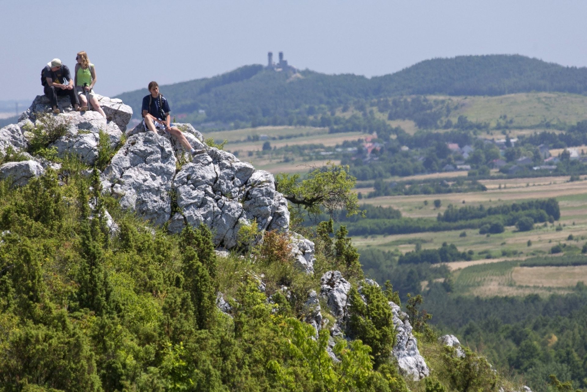
Speaking of Chęciny... we cannot forget about the Miedzianka Mountain. The hill is approximately 10 km from the castle. You can leave your car in the car park in front of the Chamber of Ore Mining.
You might as well have a rally: a yellow hiking trail leads from Chęciny to Miedzianka. The approach to the summit is not too strenuous, nor is the orientation in the area. You can easily walk up to the top.
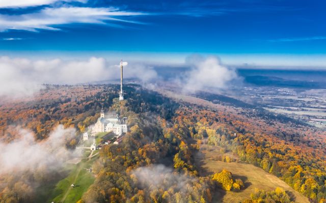
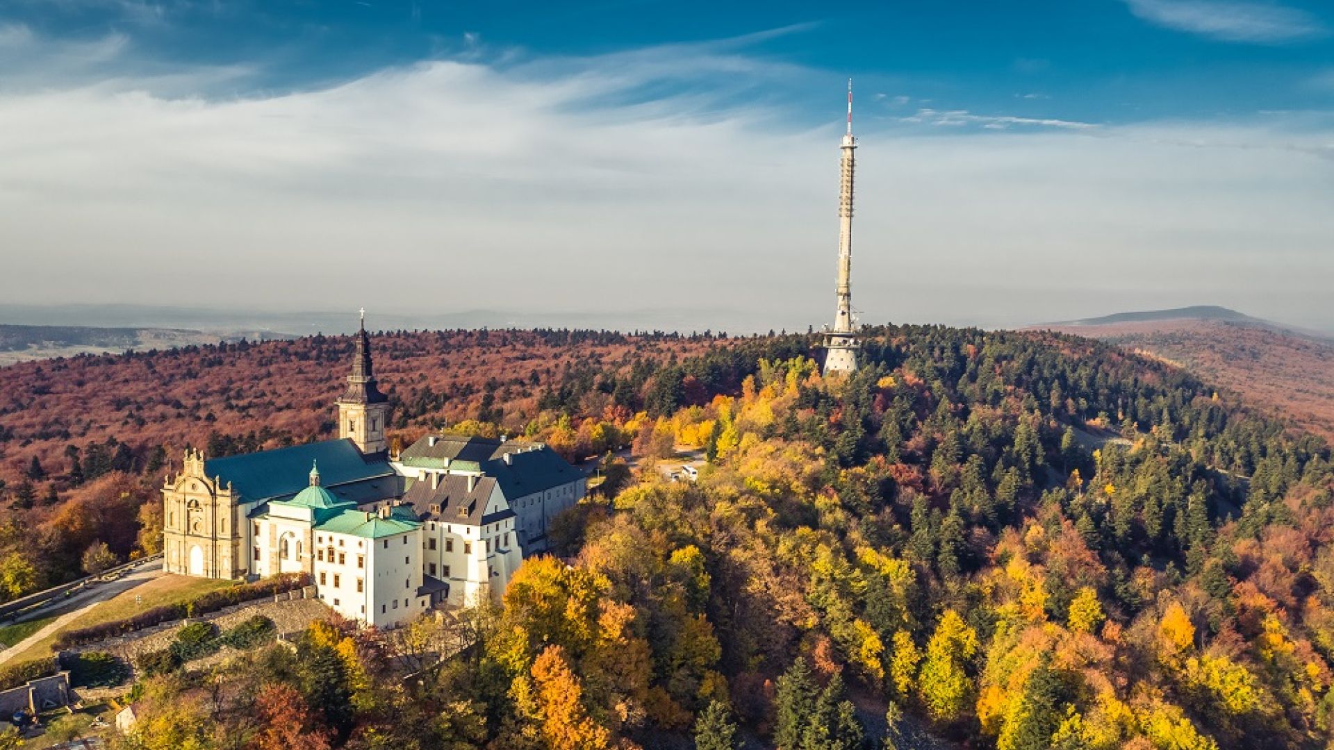
Łysa Góra – a viewing tower and a platform on the stone run
For many this will be another obvious point. For others - a sentimental journey and a big WOW, because on a school trip a dozen years ago this place looked completely different. And still for others, Łysa Góra will be a tourist and scenic discovery.
There are two vantage points here. The first one is the platform on the stone run. Thanks to the openwork metal structure, you will enter the depths of a unique rock rubble - 500 million years of our planet's history enchanted in the grey quartzite sandstones of the stone run at your fingertips. And in the background, views of the valleys, mountains and towns to the north of the Łysogóry Mountains.
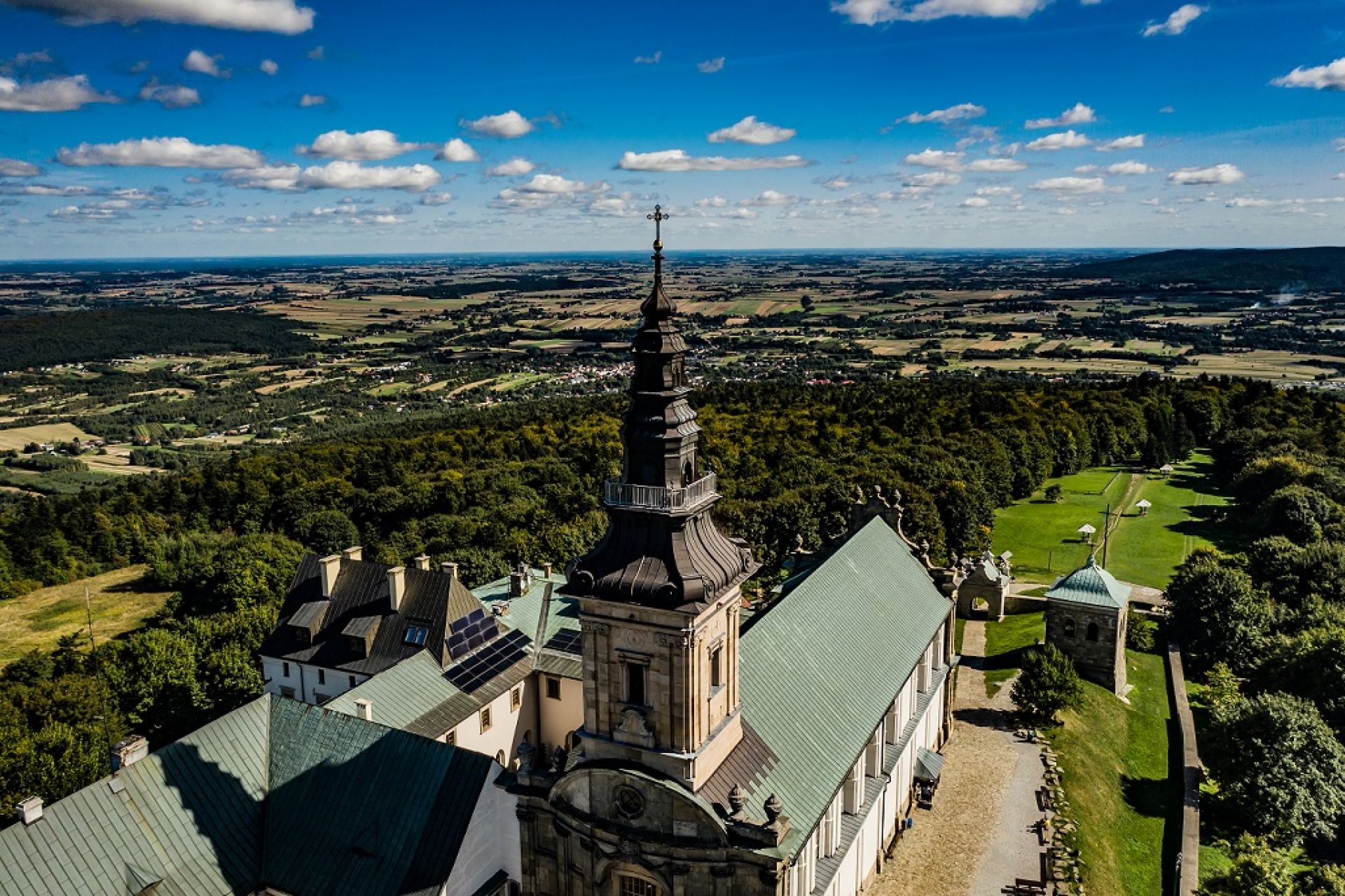
One of the most interesting views of the Świętokrzyski National Park is from the church tower of the monastery on Łysa Góra. The summit itself rises 595 metres above sea level, and a terrace for tourists has been built at 35 metres above courtyard level. Is it worth the climb?
The Strawczyn area - not only Sienkiewicz
When you hear "Oblęgorek", you think: Sienkiewicz. Relax, there is no reason to panic - we feel the same way;) But Oblęgorek and the surrounding area is also a fantastic area for cycling. The yellow trail of the Strawczyn municipality will lead you along interesting routes and the wilderness of the area.
In the village of Oblęgór, it is worth hopping onto the black trail. Then a long and steep uphill ride up Sieniawska Mountain (as a consolation - you can always bring your bike up, and going down this route is pure pleasure). And at the top - surprise! The viewing terrace rises 6 metres from the mountainside. Below is the Strawczyński Hollow, in the distance Kielce and the castle in Chęciny.
Time for a souvenir photo and a rest - at the viewpoint you will find a designated barbecue area and a site full of scientific curiosities. The point is one of the stops on the educational-natural trail in the Strawczyn municipality.
You are not keen to ride a bike? No problem. You can easily reach the viewing point by car.
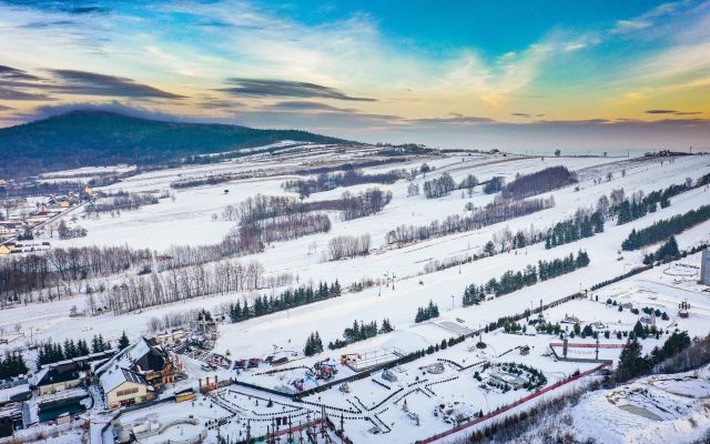
Kielce – Telegraf and Pierścienica
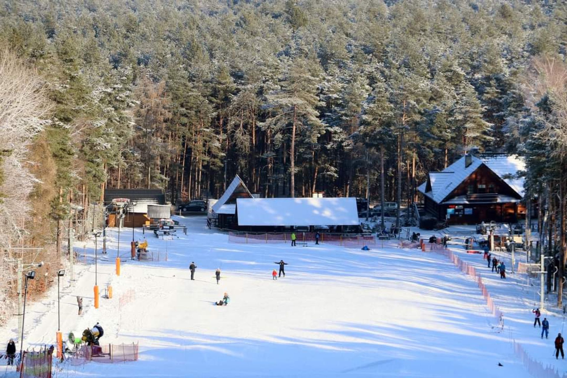
In the winter, two ski resorts operate in the southern part of Kielce. Both on natural hills. From the upper stations of the ski lifts you can see Kielce and the surrounding ranges of the Świętokrzyskie Mountains. A blue hiking trail runs nearby, so you can make a short rally from one mountain (Telegraf) to the other (Pierścienica). Telegraf - the highest point in Kielce (408 m) - is also one of the peaks included in the Crown of the Świętokrzyskie Mountains.
Krajno - a drive-thru view
Łysica (the highest peak in the Świętokrzyskie Mountains) is not the best vantage point. The slopes are overgrown with fir forest. Take the trail to Łysica when you want to walk through the Świętokrzyski National Park, see the stone run and the ancient fir forest.
And if you are looking for spectacular views, then Krajno, on the voivodeship road no 752, offers a vantage point for motorists.
At the bottom of the Krajno Ridge lies the Wilkowska Valley opening up a vast expanse of space. It is surrounded by the forested peaks of the Świętokrzyskie Mountains. This is one of the most iconic panoramas, on which many a guide has learnt the ropes.

With a view of the Queen
All right, but where is the best point to see the Łysogóry Mountains from? For motorists, we recommend road no 751 from Ostrowiec Świętokrzyski near Stara Słupia. As you drive sharply downhill, the Holy Cross rises up in front of you. The peak dominates the entire landscape, the dark colours of the massif stand out against the blue of the sky and the bright colours of the surrounding fields. From here you can admire the might of the Łysogóry. You can see why Łysiec used to be called the "prince" of the mountains.
The excitement is far from over.
First a short stop to try the iconic ice cream in Nowa Słupia and then we take the voivodeship road no 751 to Bodzentyn. On the left - we can see Łysogóry in all their glory and splendour. If you drive a little further past Bodzentyn towards Suchedniów, the road will take you to Wzdół Rządowy. These surroundings strongly inspired Paweł Pierściński - the father of the Kielce School of Landscape.
Narrow striped fields undulate gently amidst the forests that cover the Świętokrzyskie Mountains. There is plenty of inspiration. Also amateurs can take great photographs here. One of the most interesting places in the area is the so-called Barbarka Hill. It is worth stopping by the chapel to catch your breath and look at the Klonowskie Range of the Świętokrzyskie Mountains.
If you happen to have a free hour, the black hiking trail starts from Barbarka and leads to Kamień Michniowski - a charming rocky outcrop hidden among the forests. It is particularly beautiful in the autumn - colour therapy among the gold, brown and red leaves is guaranteed.
Now that we've seen the Prince of the Mountains, it's time to meet the Queen. If you want to see Łysica in one of its more interesting views, and take a walk at the same time, we highly recommend Ciekoty. The summit is perfectly visible from the area by the Stefan Żeromski Manor House. It is reflected in the surface of a small pond. Peace and quiet - it's right here!
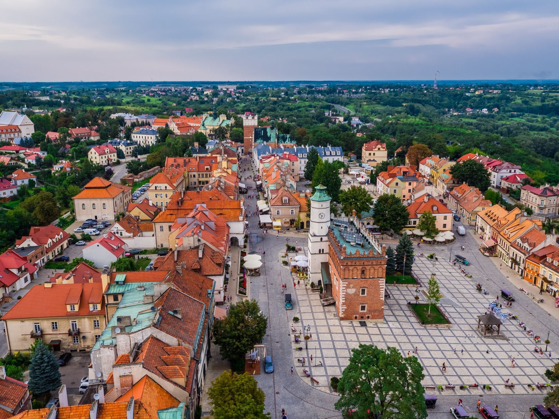
Sandomierz
The heart of the city is undoubtedly the Old Town and Market Square. From spring to late autumn, you will find crowds of visitors here - admiring the historic town houses and the brick town hall, looking for the most interesting souvenirs at the stalls, exchanging their impressions after a visit to the Underground Tourist Route or simply relaxing in one of the restaurants or cafés.
A good idea to plan your Sandomierz sightseeing route is to look at the city from above - preferably from the Opatowska Gate. Just climb five storeys up an atmospheric wooden staircase and you will find yourself on a terrace 32 metres high. From here you will see the entire, picturesque historic city of Sandomierz, with its winding streets and town hall tower on the banks of the Vistula River.
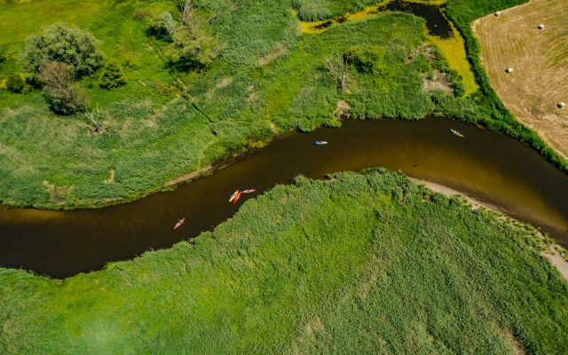
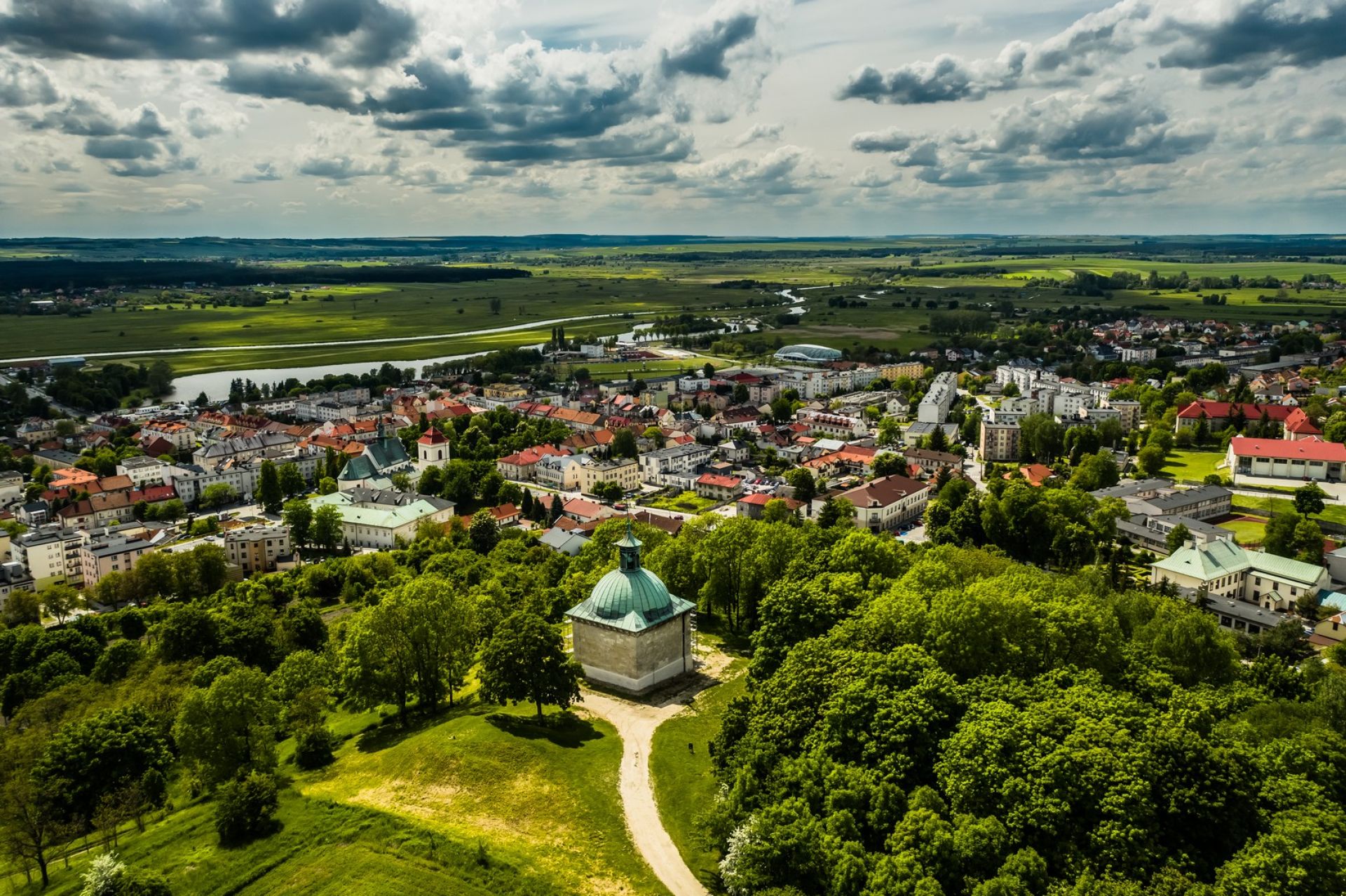
Pińczów
Saint Anne's Mountain in Pińczów is delightful at any time of the year with its symphony of colours of the surrounding nature. Situated in the northern part of Pińczów, it is an ideal place for a short walk or a picnic. Here, the panorama of the town spreads out at your feet. The meandering lazy Nida River glistens in the sunshine.
In the background is a gentle line of forested small hills of the Kozubowski Landscape Park. You can relax while enjoying the beautiful view. Take a blanket, some good food and your camera to capture carefree moments in the gentle Ponidzie region.
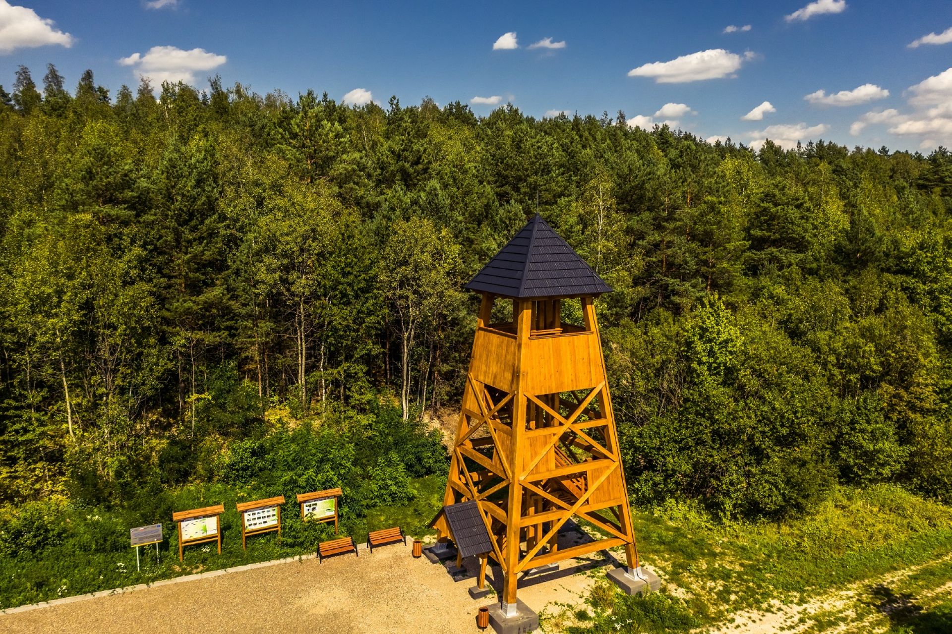
Daleszyce
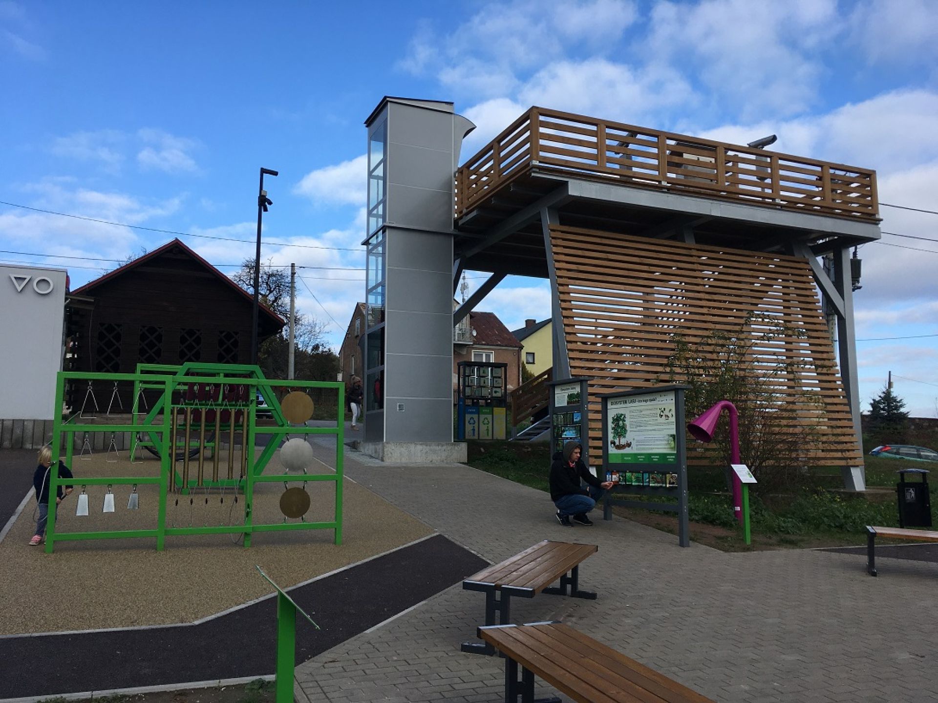
The wooden structure of the viewing tower in the municipality of Daleszyce rises to around 15 metres. You can get there on foot (there is a hiking and nature trail in the form of a loop around the area, as well as walking trails to Cisów and Widełki) or by car (you can safely leave your car near the viewing platform).
From the tower you can see the panorama of Daleszyce - a small Świętokrzyskie town of the Cisowsko-Orłowińskie forests. This is one of the newest viewing sites in our region. We are curious to know if you like it.
Geographical coordinates of selected points:
Royal Castle Chęciny – 50°47'50.3"N 20°27'39.3"E
Museum in Miedzianka – 50°50'40.6"N 20°21'55.1"E
Miedzianka Mountain – 50°50'50.0"N 20°21'32., 0
Łysa Góra – Monastery - 50°51'33.3"N 21°03'10.3"E
Sieniawska Mountain - 50°58'10.3"N 20°26'31.2"E
Kielce – Telegraf - 50°50'18.3"N 20°38'31.0"E
Kielce – Pierścienica - 50°50'19.5"N 20°36'00.5"E
Krajno - View point - 50°53'29.3"N 20°51'49.8"E
Near Saint Barbara Chapel - 50°59'19.7"N 20°51'53.1"E
Ciekoty Manor House – 50°54'35.3"N 20°48'33.1"E
Sandomierz – Opatowska Gate - 50°40'53.3"N 21°44'58.3"E
Pińczów – Saint Anna Mountain- 50°31'18.9"N 20°31'51.5"E
Daleszyce View Point - 50°49'03.1"N 20°49'19.1"E
Zobacz także